Planning Commission Agenda, 2025-03-13
UPDATE 2025-08-12: Corewell Health seeks to break ground this fall on 125-unit mixed-use project, Crains 2025-08-12
The municipal agenda for the Planning Commission meeting on 2025-03-13 is 👉here👈
Welcome to Parking Palooza 2025!
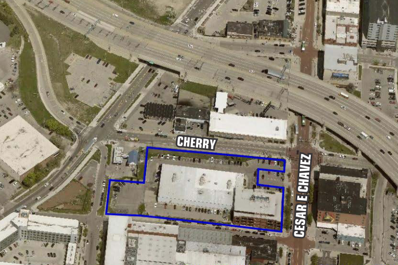
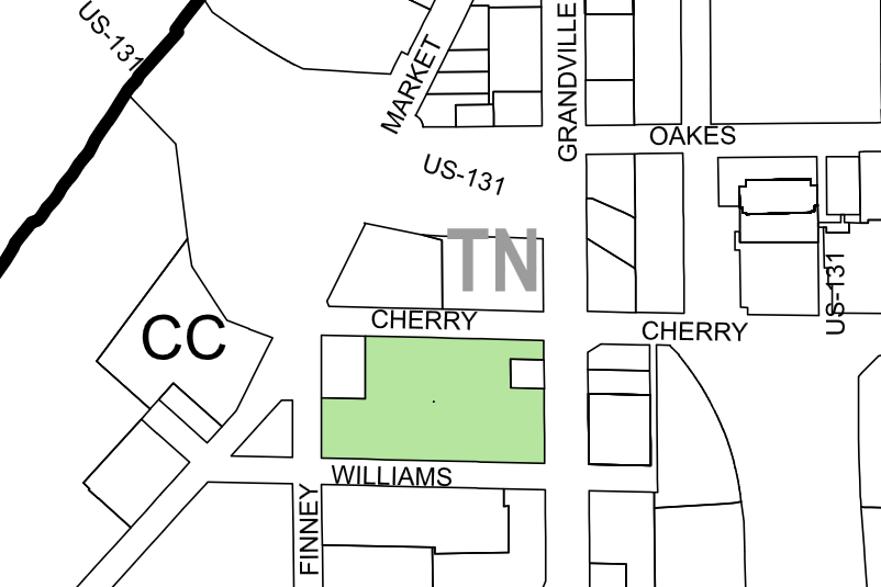
633, 637, & 647 Ottawa Ave NW
They are back! And with the exact same plan as last time. This is a Special Land Use to demolish buildings in Monroe North - which were purchased and vacated by Corewell Health - in order to construct a surface parking lot. Didn't they already ask for permission to demolish nearly this entire neighborhood in order to convert it into a suburban office park? Yes, they did, on October 26th of 2023. Fortunately, at that time the Planning Commission took note of the clear dissonance between the variety of plans related to Monroe North which had been adopted by the Grand Rapids City Commission, as well as the discordance with the intended public investment of tens of millions of dollars into canal park, the Belknap Bluff, and the former railroad underpass [to be converted to pedestrian right-of-way]. At that time this request was tabled.
The Request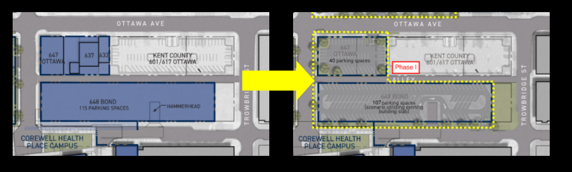 |
Aside: Corewell has repeatedly referred to buildings in this area as "vacant" and "blighted". These buildings were not vacant when Corewell purchased them. If they are blight, that is blight of Corewell's making. It is disingenuous to use their current status as an argument. Corewell, as owners of the properties, is free to renovate these buildings, to sell them, or lease them to tenants. The creation of a surface parking lot is the only use which requires Special Land Use. Corewell is free to demolish these buildings and build a fourteen story building - doing so would require no special dispensation.
All of those plans which were relevant to Monroe North in 2023 are still relevant today, and all of those investments are still in process. What has changed? Corewell is advancing the idea of another component of their original plan: a residential building across the street from this parking lot. That is a distinct project which in the zoning district of this property (TN/.CC) they are entitled to build by right. Importantly that residential facility is labeled as "Phase II", the parking lot is "Phase I"; so, if granted the Special Land Use, Corewell will be entitled to demolish the buildings at these sites, create a surface parking lot, and .... then do nothing at all. The Special Land Use Request is not contingent on any other development, and the Planning Commission does not have the authority to obligate Corewell to build anything in the future.
Is this an appropriate use for this property? When the city intends to invest so much in this neighborhood? When the elected City Commission has adopted numerous planning documents related to the neighborhood?
 |
 |
 |
Images of the city's intended ~$40,000,000+ investment in the Monroe North neighborhood; not including the redevelopment of Canal Park and the underpass!
In ~2014 the City spent thousands of hours and hundreds of thousand of dollars engaging hundreds of residents to develop the GR Forward plan. This plan identified the following goals:
- RESTORE THE RIVER AS THE DRAW & CREATE A CONNECTED AND EQUITABLE RIVER CORRIDOR
- CREATE A TRUE DOWNTOWN NEIGHBORHOOD THAT IS HOME TO A DIVERSE POPULATION
- IMPLEMENT A 21ST CENTURY MOBILITY STRATEGY
- EXPAND JOB OPPORTUNITIES & ENSURE CONTINUED VITALITY OF THE LOCAL ECONOMY
Does this demolition of buildings for the purpose of surface parking align with the GR Forward goals?
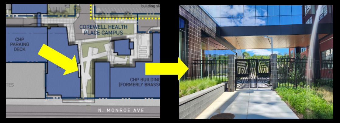
Corewell continues to show this area on their development plans. This portion of the plan was pitched as green-space and honoring the pedestrian friendly design requirements of the Monroe North Corridor plan and the GR Forward Plan. It is, in fact, a locked gate. This connection to the river is not useful to the residents of Monroe North or any of the adjacent neighborhoods. The design of this site is in clear violation of the first directive of the GR Forward Plan: CREATE A CONNECTED AND EQUITABLE RIVER CORRIDOR. Corewell has designed the Innovation Campus not as a part of a neighborhood, but as if they own the neighborhood. However, no one owns a neighborhood, they are participants in the neighborhood.
 |
If granted the demolition would allow for the creation of a forty (40) space surface parking lot. Corewell would complete construction of the parking lot by November of this year (2025). The "Phase 2", the residential development to the east, if constructed would possibly be completed in the second quarter of 2027. Or that site to the east could remain what it is today: a surface parking lot.
The proposed residential development to the east of this site - which is not contingent on this Special Land Use - would be intended for Corewell medical residents and provide 125 units in a mix of one, two, and three bedroom units. Due to the slope of the site the property is accessible on a ground floor from the east and the west; both ground floors would provide parking for residents. A total of one hundred forty (140) parking spaces would be provided within the residential development itself; more than one space per unit.
Corewell's "Master Plan" For Monroe North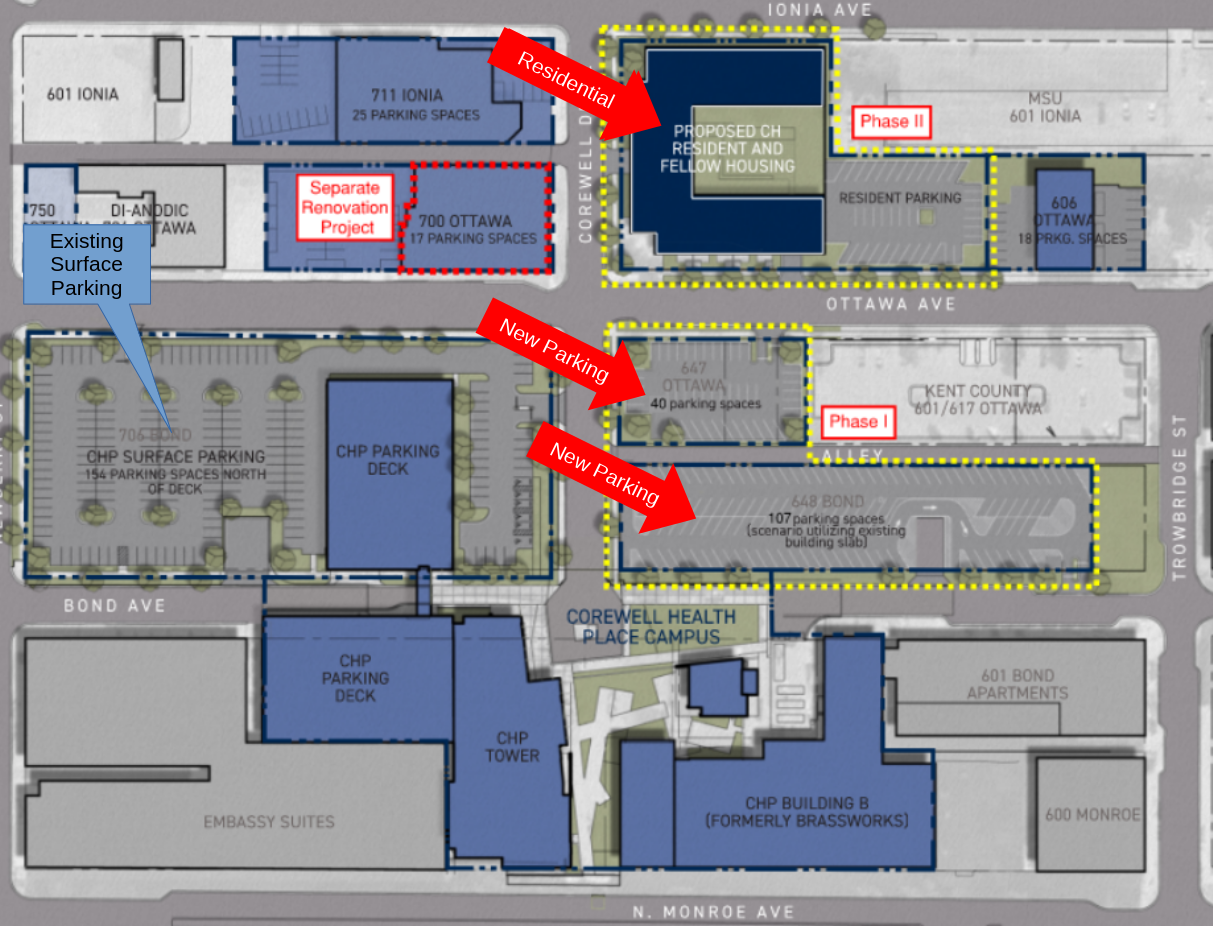 |
|
Residential First Floor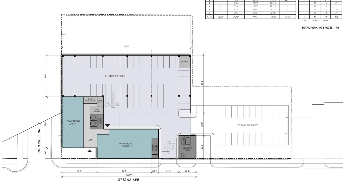 |
Residential Second Floor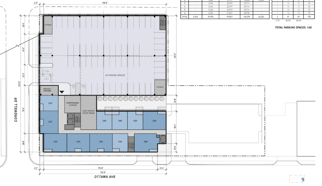 |
The development of additional residential in the Monroe North neighborhood is something to be applauded; the entire city needs more residential development of all types. And Corewell cites the proximity to Medical Mile as a critical component in their choice to develop this capacity at this location [yes, for such a parking obsessed institution this awareness of proximity is ironic]. Indeed, the use of the site's slope to accommodate on-site parking capacity while fulfilling the obligation for active uses on Ottawa Ave is well done.
Residential Rendering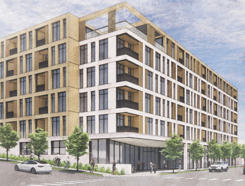 |
Corewell's Proximity Illustration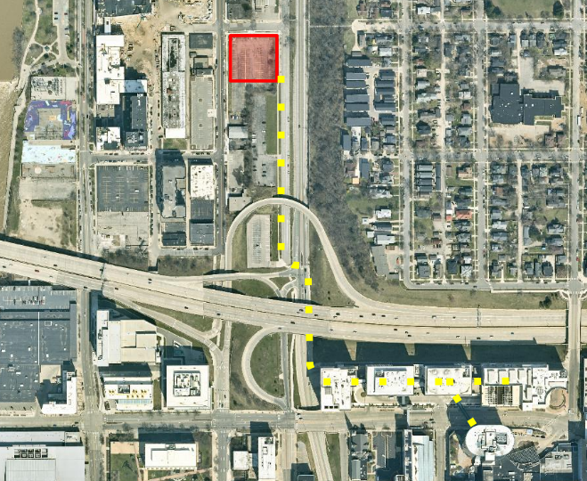 |
No criticism of Corewell's obsession with parking should be interpreted as a criticism of this well designed development. As stated, this development does provide the required active uses on Ottawa Ave which the Monroe North plan specifies as a pedestrian friendly street. The Monroe North plan also states “surface and ground floor parking screened from priority pedestrian streets by buildings/active uses”. No screening of the surface parking is included in the plan.
This Special Land Use request is case PC-SLU-2025-0008, please reference that in whatever correspondence you choose to send to the Planning Commission. An e-mail should be sent To: planning@grcity.us; optionally you may choose to include the City Manager as well @ manager@grcity.us.
Correspondence related to Planning Commission agenda items should be sent by end of business day on Wednesday, March 12th.
As this is the first item on the agenda for this meeting it will be very convenient for citizens to attend the Planning Commission in person to make public comment.
Please consider joining StrongtownsGR in our opposition of this request; and supporting the plans (Monroe North Corridor Plan, Michigan Street Corridor Plan, GR Forward, and the community Master Plan) which were created through hundreds of hours of citizens engagement and then adopted as policy documents by our elected City Commission. Your voice matters.
News
- Corewell Health details residency housing plans at Grand Rapids headquarters, Crains 2025-02-10
- Corewell Health seeks to break ground this fall on 125-unit mixed-use project, Crains 2025-08-12
217 Cesar E. Chavez Avenue SW
This Special Land Use (SLU) request by the Ellis Parking Company is to use a parking lot as it has been used for the previous fifteen (15) years, for which it did not have the correct approval. Currently, and for previous years, the parking has been used - Monday through Friday - by the tenants of the structure on the property, and after-hours it has been used by Ellis Parking customers for parking for the adjacent venues. Soon those venues will include the Amphitheater. After hours is considered to be 5:00pm - 2:30am Monday through Friday and 6:00am - 2:30am Saturday and Sunday. Ellis Parking does staff the lot to control after hours use.
 |  |
Current business hours tenants are: Custer/Canyon Equities, Revolutions Farms, Moonshot Ventures, Nederveld, Siren and Proper, CSE, and Floors New. Only Siren and Proper and Floors Use make use of the facility after hours. When used for parking the Ellis Parking employees have access to the facility for restrooms and break facilities.
No changes to the current site are planned.
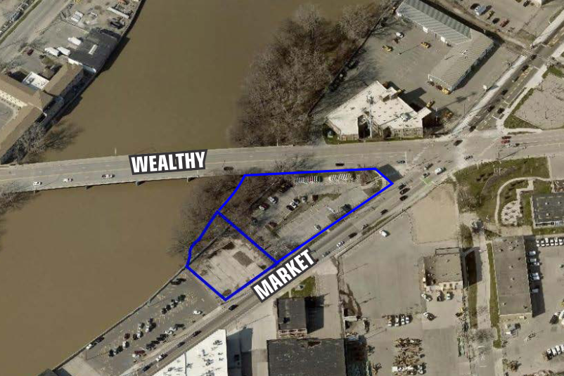
427 and 449 Market Ave SW
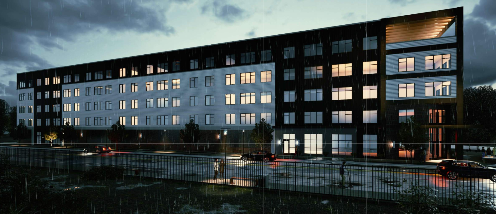
This request is related to five story eighty (80) unit Affordable housing development at the intersection of Wealthy St and Market Ave, along the planned riverside trail. A Plan Review is related to parking in the front of the building (this is a corner lot) which is frowned upon by the form requirements of the district, and for Special Land Use (SLU) for ground floor residential. Typically the ground floor use of a building in a mixed-use district is expected to be an active use such as retail, service, or potentially office space. The applicant's ground floor plan includes no residential units but does contain the residential amenities - hence the Special Land Use. The majority of the ground floor is covered parking (46 spaces), with the portion nearest the intersection allocated for an active use. An additional thirty-four (34) parking spaces are arraigned around the building. The total is eighty (80) parking spaces, or one per unit.
A quarter (25%) of the buildings ground floor facade along Market Ave will be occupied by the active user, and the entirety (100%) of the narrower ground floor facade facing Wealthy St. The facade facing the river and the river trail will be entirely inactive (parking).
 |  |
Ground Floor & Site Plan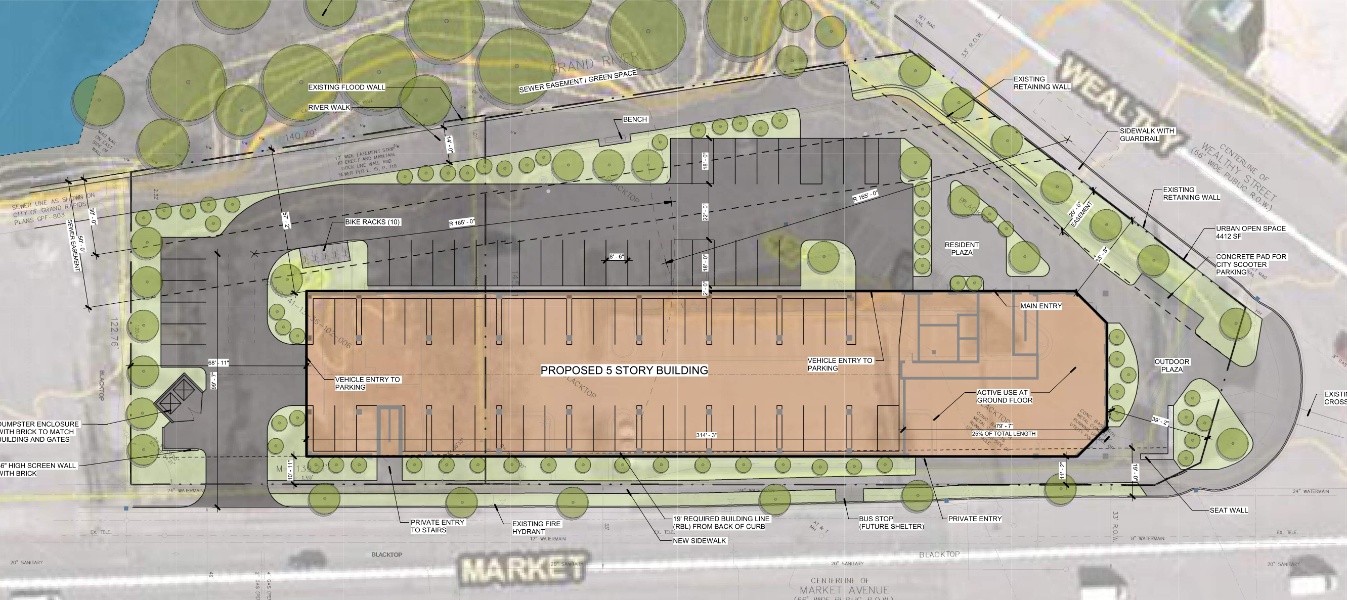 | |
The city will hold a fifty (50) foot set back along the rear of the property, along the river, to retain the possibility in the future of the river trail extending south of Wealthy St. There has been criticism of this projects site design as (1) being very parking heavy for an Affordable housing development, (2) placing surface parking on what is considered to be a premier location on the river trail before it meets the Oxford Trail, as well as (3) under-utilizing the site with an eighty (80) unit building. The site's location in the "DH-2a overlay district" allows up to ten (10) stories by-right, and the TN/CC zone district imposes no parking requirement. Adjacent to the river trail, located on a major corridor, and sited so near major investments such as the Amphitheater . . . is this the highest-and-best possible use of this site? More housing is a critical need; it is also true that this development is particularly disappointing and low-effort.
 Users of the river trail [provided it is ever constructed], along the rear of the building, will enjoy the ambiance of a parking lot and parking deck. |
In the spirit of saying something nice; the fifth floor contains a south-west facing patio, which from this site, is something myself - if I were a resident - would very much enjoy. The view will be of the river, the Oxford Trail Bridge, the green of the superfund site on the west side of the river, and the industry of Market Ave. An industrial view is something I always appreciate, the places where people do actual work. US-131 is away to the east, out of the sight-line, where it should be.
Fifth Floor (right is south-west)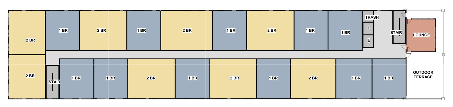 In later documents the lounge was replaced with an additional residential unit. In later documents the lounge was replaced with an additional residential unit. |
Half of the site is owned by the city of Grand Rapids having previously used as a parking lot for bus layovers. The sale of the property is conditional on use with minimum affordability requirements of at least 80% of total units affordable at 120% AMI ($84,600/y - $120,840/yr) or lower, with 40% of those units affordable at 60% AMI ($42,300/yr - $60,420/yr) or lower. The building is a mix of one and two bedroom units. The developer may option up to three (3) years before development begins.
Note: The documents contain an inconsistency related to the unit count, some documents have stated this is a seventy-five (75) unit building, and others state it is eighty (80) units. The most recent documents say eighty (80), and one of the documents references a minimum of seventy-five (75); I am assuming that eighty (80) is the correct and current unit count.
News
- Riverfront affordable housing plan tabled over parking concerns Crains 2025-03-14
500 Lake Michigan Dr. NW
As part of the deal with Grand Action to build the 👉Soccer Stadium👈 on what is today DASH and YMCA parking lakes the YMCA will have access to the desperately underutilized and overbuilt GVSU parking ramp. To accomodate both YMCA customers and stadium patrons a skywalk has been proposed from the second floor of the parking ramp, over the railroad and street intersection, to the north east corner of Pearl St and Winter Ave. The stair and elevator tower at Pearl & Winter will have both a street entrance and an entrance into the YMCA.
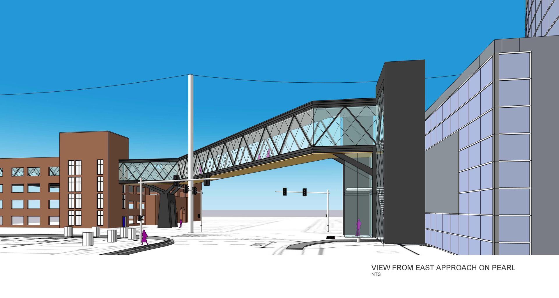 | 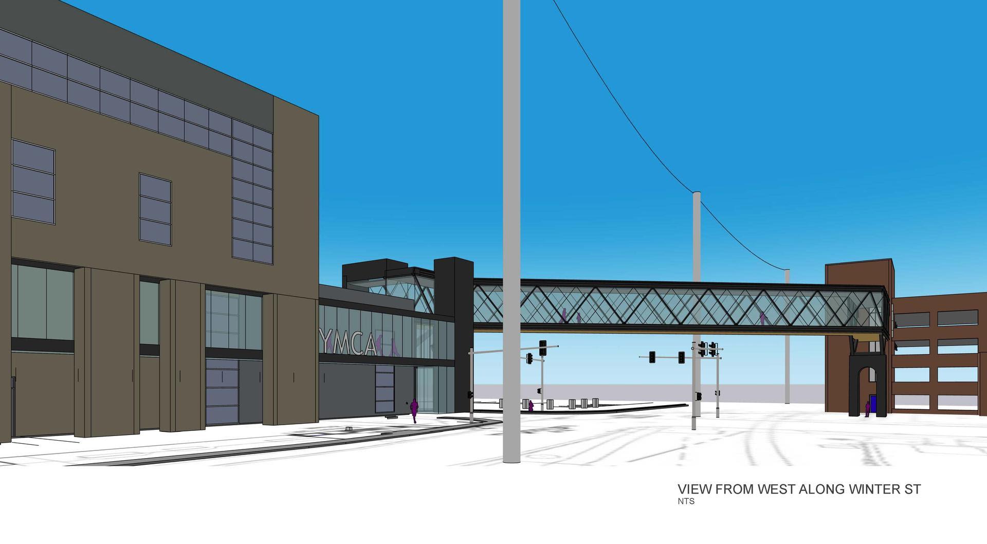 |
The CSX railroad, which owns the right-of-way along Winter Ave, has already consented to the construction of the skywalk. The skyway will exceed the required clearance (23ft) for passing over a railroad.
Overhead pedestrian walkways require Special Land Use (SLU) in all "mixed use" zones other than TN/TBA (Traditional Business Areas) and NOS (Neighborhood Office Space) where they are not permitted.. Given the nature of the use this seems like a rare instance where Special Land Use is being used appropriately.
News