The Broken Sloping Grid
Preamble: This is a post about the neighborhood of Highland Park by a resident.
In response to the previous post - Fantasy Map (Parks) - someone pointed out that part of the answer has to be connectivity. An alternative to making more of something closer to where someone is, is to make what exists closer. AKA: connectivity. Something may be nearby, yet if there is a barrier between you and it, then it is effectively further away. This is a good point. So, before we can talk about more issues like paths or trails or housing or commerce we need to take a step back and look at the neighborhoods connectivity.
The ideal connectivity for an urban space is The Grid. An unbroken grid of straight streets and modest consistent block size provides the maximum in connectivity; moving between any two points requires the least travel distance. This is a mathematical, indisputable, truth.
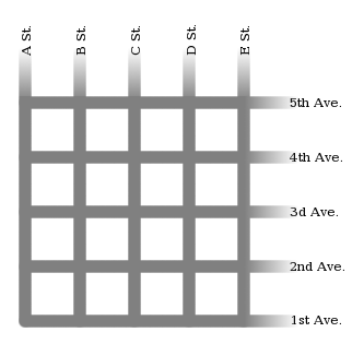
An ideal grid
Of course there are many things which legitimately break a grid: cliffs, rivers, valleys, railroads, as well structures larger than a block [like a park!].
Additionally the world is not flat. A grid is a two dimensional structure in a 3D world; as anyone who lives on Lydia St is aware; Highland Park emphatically not flat.
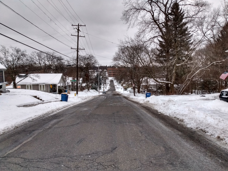
Lydia St; who hasn't spider-scrambled up and down this hill in the winter?
Hint:There is a chain link fence on the south side that can be used as a hand-rail.
Highland Park's grid is broken and sloping.
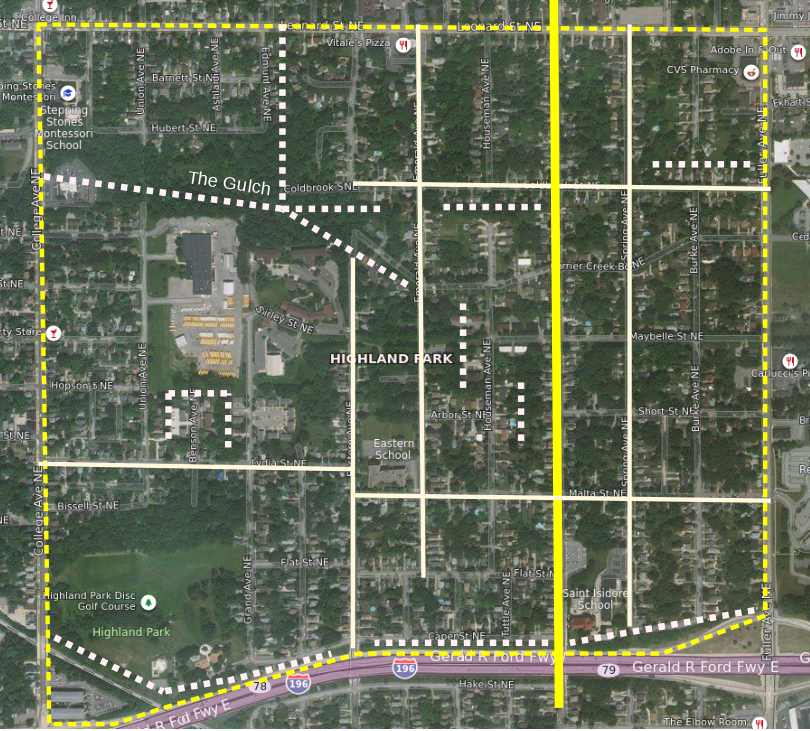
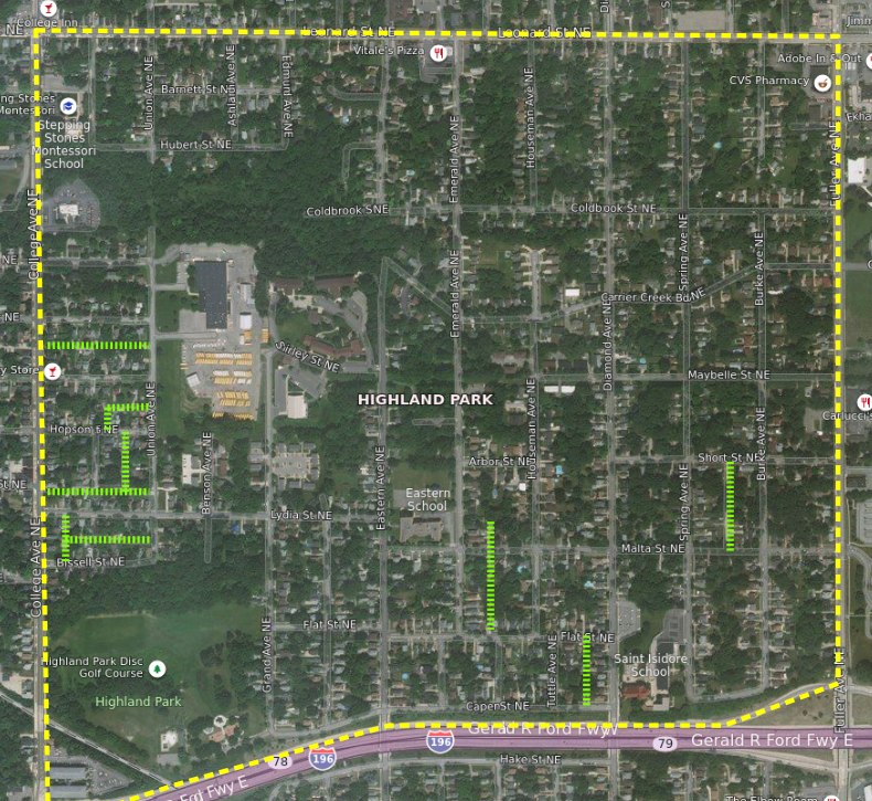
Highland Park's Broken Grid
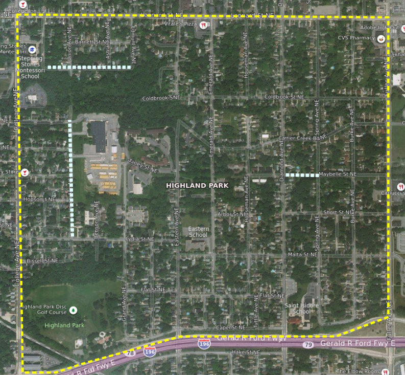
In the Broken Grid map I've highlighted the one street (Diamond Ave) that goes all the way through the neighborhood, the six streets which penetrate five or more blocks into the neighborhood, and the barriers (dashed lines) where there is no official way through for vehicles or pedestrians. There are a lot of barriers.
Aside: Due the the existence of paper streets [streets that exist only in government documents, not in the real world] an online map presents more connectivity than exists. For example, most online maps show Eastern Ave connecting to Carrier Creek, it does not. A few online maps even show Union Ave as spanning The Gulch, as contiguous from Bissell St to Leonard St; it is not.
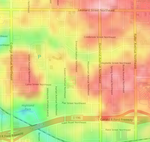
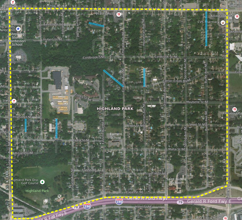
Elevation
White is highest (800ft), followed by red, then green, and blue is lowest (650ft).
Most of these barriers are either created or amplified by the neighborhood's topography. Highland Park's elevation, within its scant 0.65sq/miles, varies by ~100ft. That is the height of a nine story building! One of the highest points (776ft) is located only ~850ft from the lowest point (672ft).
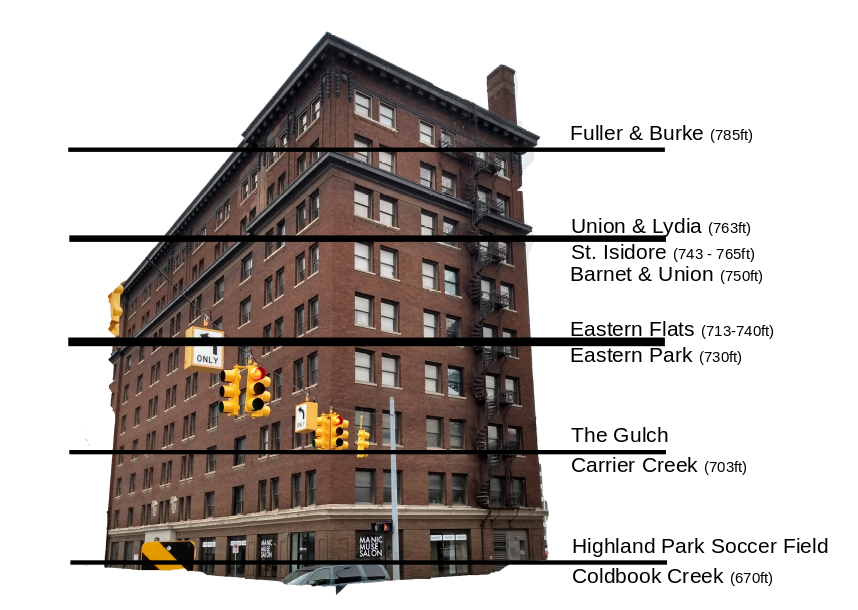
If the neighborhood were a nine story building
The neighborhood, due to elevation changes and fractures in the grid, can seem like it is more of a confederation of 3 - 4 very small neighborhoods. On the other hand this broken sloping grid creates some of the neighborhood's most interesting features - as well as some impressive views. If you know the neighborhood's secrets it is easy to disappear into its creases. From within those creases it is difficult to imagine oneself a mere 1.5 miles from the city center, or less than a mile from The Medical Mile, or even a few hundred feet from the Michigan St. Corridor of Midtown.
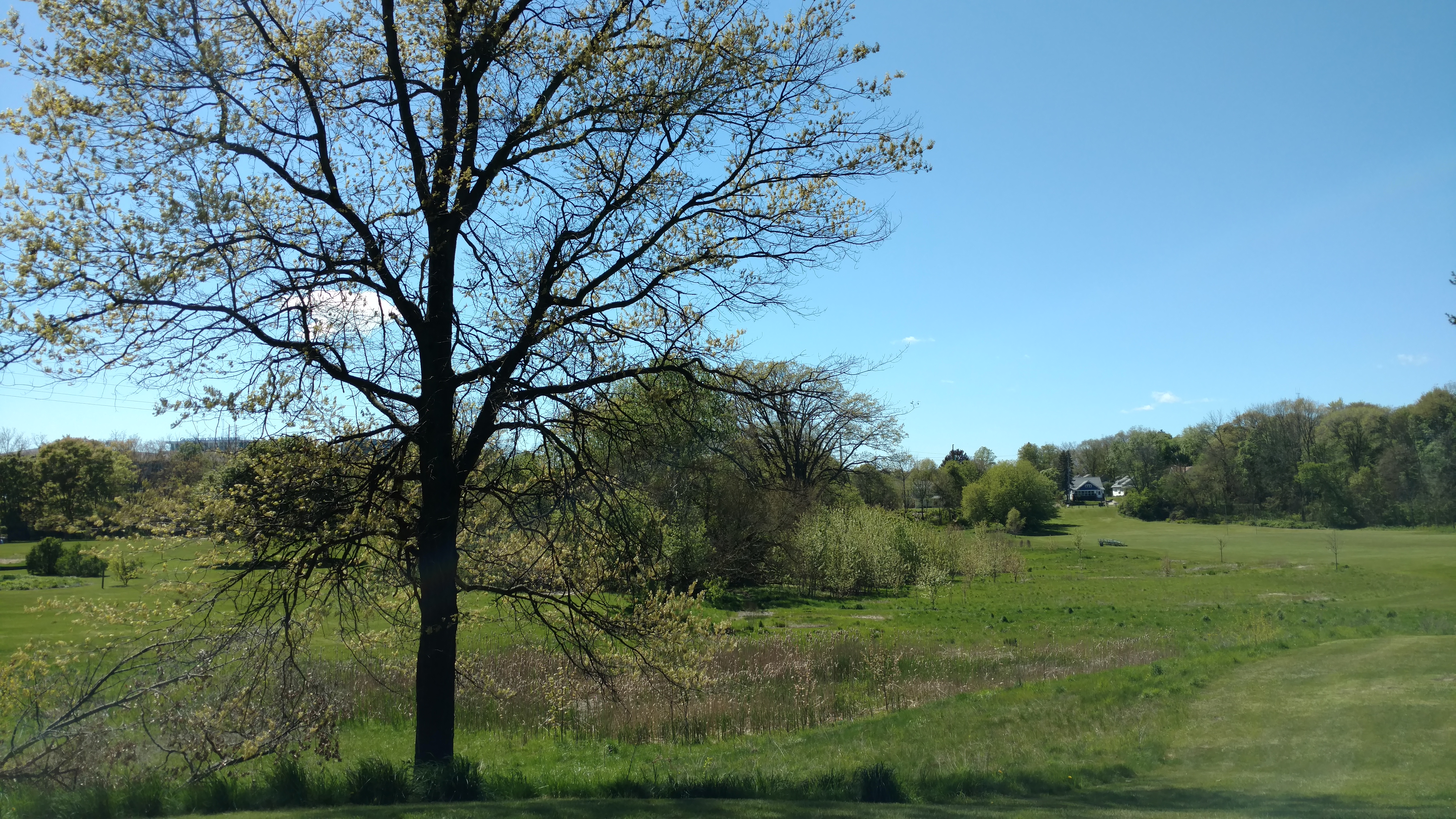
View
If this does surprise you, that people care so much about a drainage ditch, then I recommend you visit The Gulch in Spring when the wild flowers come.
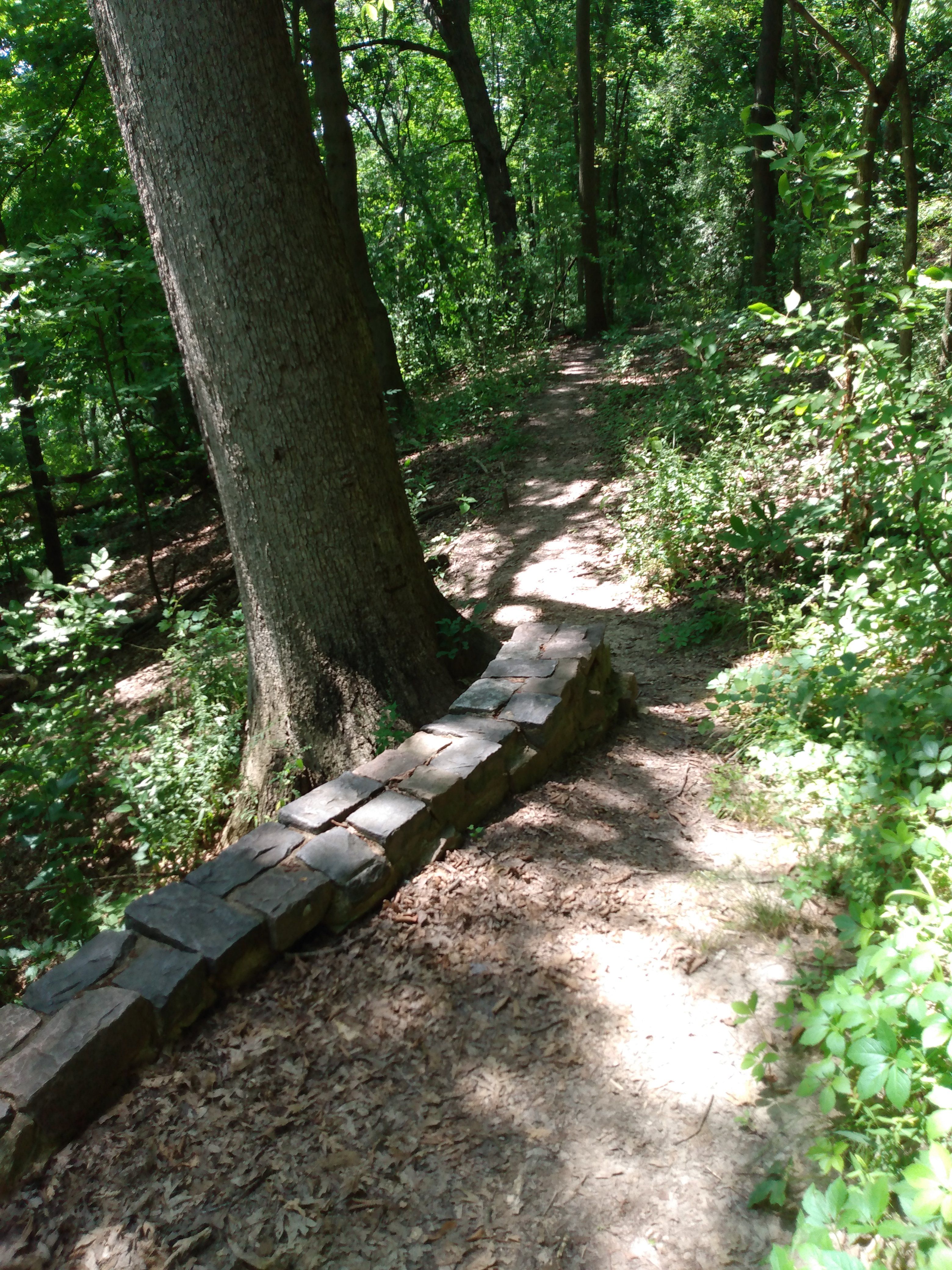 |
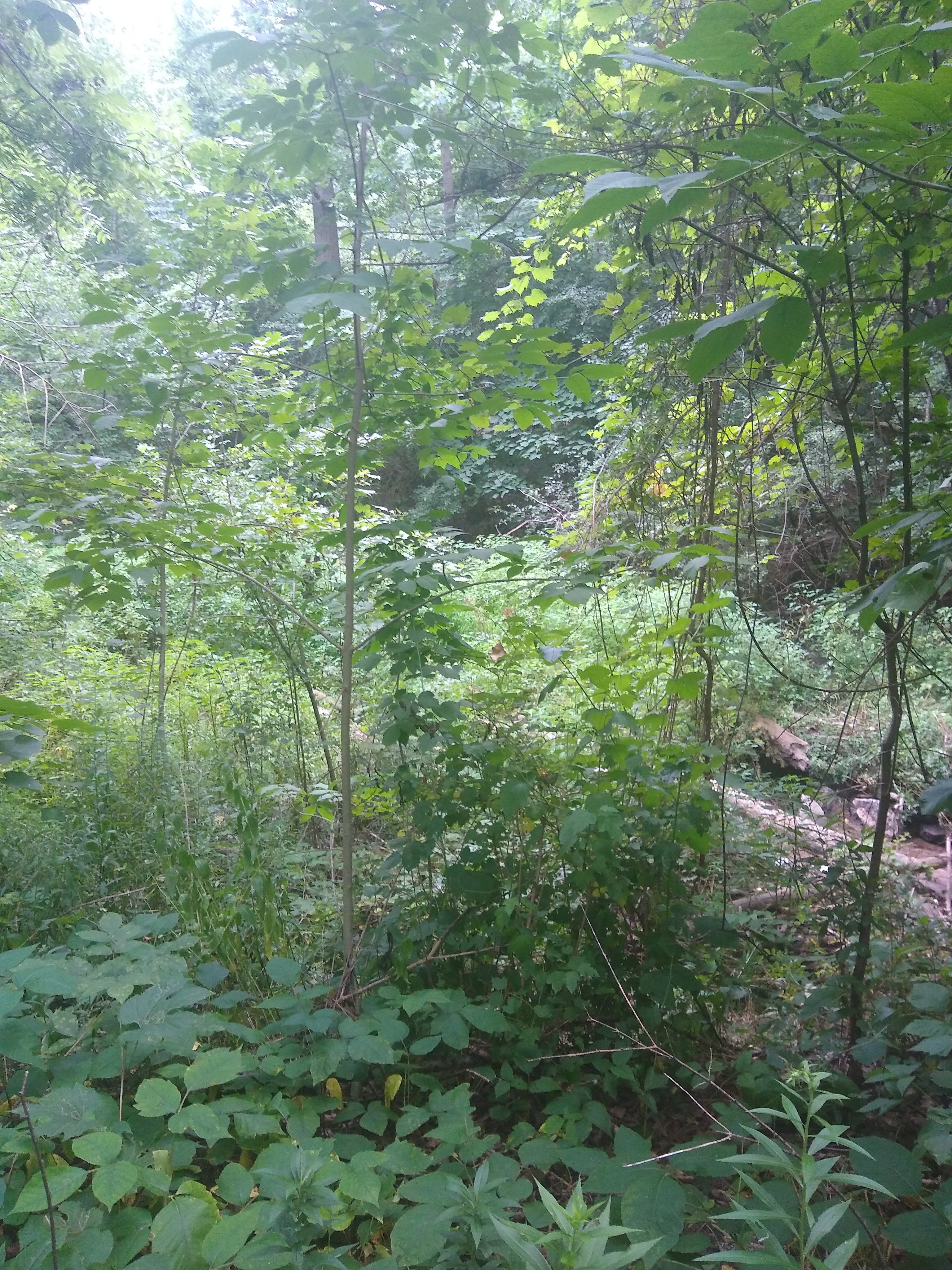 |
| in the creases, one of these is a park,the other is not. | |
Yet on the flip side of this desire to preserve is the issue of connectivity. The availability of some of these neighborhood secrets is limited to the limber and the brave. As it exists today The Gulch is not a welcoming place for everyone; some people, reasonably, do not feel safe venturing into such a space. The bluffs of Highland Park are physically challenging. And all of the features which create those breaks in the grid are obstacles to anyone, living their day to day life, moving through the neighborhood by foot or bicycle. They limit the accessibility of transit routes on Leonard, College, as well as Michigan St.
I believe the best way to preserve these creases is to make them official, and at the same time making the neighborhood more of a whole. Which is what we will fantasy map next.
More Maps...
There are other factors related to connectivity which will come up in later posts. Most notably are the existence of alleys, streets without sidewalks, and Cul De Sacs. Here are maps of those features in the neighborhood.
Note: Thanks for all the feedback on these maps. They are a work in process, I am still updating from comments on Nextdoor & Facebook. Additional comments are certainly welcome.
Alleys |
Streets without sidewalks |
Cul-De-Sacs |