Submitted by whitemice on Sun, 02/09/2025 - 13:46
The municipal agenda for the Planning Commission meeting on 2025-02-13 is 👉here👈
2160 Celebration Dr NE
UPDATE 2025-03-13: This development is dead, the developer has listed the property for sale.
Submitted by whitemice on Fri, 01/24/2025 - 18:00
2015 - 2024
How as Grand Rapids' rent changed in the last ten years?
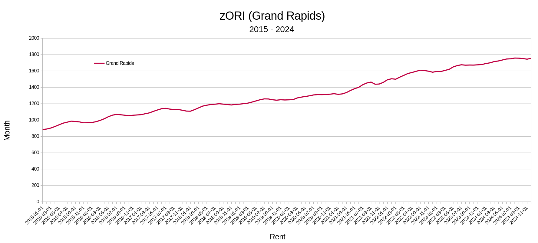
Submitted by whitemice on Sat, 01/18/2025 - 12:27
Given that we are about to enter into a season of constant housing and land-use policy conversation it seems like a good time to update the "A"ffordable housing tables. The standard for "A"ffordabilty is for the total monthly housing costs not to exceed 30% of gross household income. For the state and federal governments this calculation is always made off of the median household income of the county; that is the number which matters in the context of block grants, tax credits, etc...
Submitted by whitemice on Sat, 01/18/2025 - 06:10
Submitted by whitemice on Fri, 01/17/2025 - 20:36
We last looked at the state of intercity transportation in 2022; sadly, very little has changed ...

Submitted by whitemice on Fri, 01/17/2025 - 06:51
Submitted by whitemice on Sun, 01/12/2025 - 15:27
Continuing the tradition of predictions and evaluation, here are the predictions for the year 2025. Before anyone takes these too seriously remember how the 2024 predictions turned out.
1. ) Venues continue to expand; especially of the eatertainment variety. Between downtown, Bridge St, and Creston six new eatertainment venues will open or be under development.
Pages